Last updated on 2025-07-31

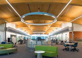


Program Overview
The Geographic Information Systems Ontario College Graduate Certificate program is designed to equip students with essential knowledge and skills in geographic and cartographic science, emphasizing information systems technology. This one-year program combines both hands-on and theoretical approaches, allowing students to delve into various topics such as field data collection, programming, remote sensing, and spatial analysis. A significant aspect of the program is the independent project that students initiate in their first semester, collaborating with industry or government sponsors to develop and complete their projects. This program is ideal for those looking to specialize in geographic science and information systems technology.
Program Structure
The Geographic Information Systems program is structured to provide a comprehensive learning experience over a duration of one year. The program includes:
- Hands-on and theoretical learning approaches
- Independent project work in collaboration with industry or government sponsors
- Optional paid co-operative education (co-op) work term, subject to availability and academic eligibility
Students will explore a variety of topics, including:
- Field data collection
- Programming
- Remote sensing
- Enterprise geo-database design and management
- Cloud-based services
- Application development
- 2D and 3D cartographic design
- Spatial analysis and project management
This program is designed to prepare students for a dynamic career in the growing field of Geographic Information Systems.
Featured Experiences
The Geographic Information Systems program offers several unique features that enhance the learning experience:
- Independent project work that allows students to apply their knowledge in real-world scenarios.
- Collaboration with industry or government sponsors for project development.
- Optional co-op work term providing paid industry experience.
- Field projects that give hands-on workplace experience.
- Integration of both classroom learning and practical application through various instructional modes.
Career Options
Graduates of the Geographic Information Systems program can pursue a variety of career paths in Canada, including:
- GIS Analyst: Responsible for analyzing spatial data and creating maps to support decision-making in various sectors.
- Cartographer: Specializes in creating maps and visual representations of geographic data.
- Remote Sensing Specialist: Utilizes satellite or aerial imagery to gather and analyze data about the Earth's surface.
- Geospatial Data Scientist: Works with large datasets to extract insights and support data-driven decisions in organizations.
- Urban Planner: Uses GIS tools to assist in the planning and development of urban areas, ensuring sustainable growth.
The demand for GIS professionals is increasing as organizations recognize the value of geographic data in decision-making processes.
DISCLAIMER: The information above is subject to change. For the latest updates, please contact LOA Portal's advisors.
Visit Algonquin College official website